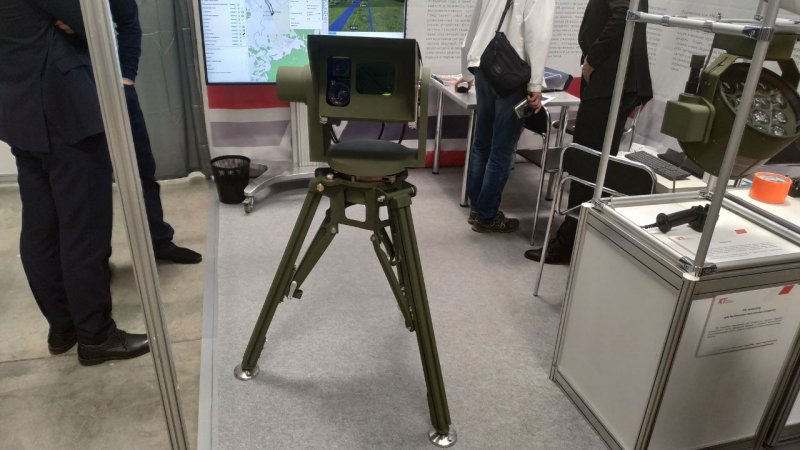
The system is designed to obtain information about actual location of an unmanned vehicle at the landing phase, reports Mil.Press Today from the Kronshtadt Group's booth.
In automatic mode, LPS scans an airspace sector of expected occurrence of UAV, then locks on and tracks the drone at glideslope phase and moving on the runway. It ensures safe takeoff and landing of the drone even with no satellite navigation data.
Locking on a UAV is possible at the range of up to 8 km and the height of up to 250 meters.
Kronshtadt Group presented the civil version of the UAV laser positioning system in 2017 at MAKS air show.
Russia Presented Military Version of UAV Positioning Laser System
At Heli Russia 2019, an exhibition of helicopter-related industries opened on May 16, Kronshtadt Group presented a laser positioning system (LPS) that locates unmanned aerial vehicles (UAVs). The company’s booth displays a military version of LPS compatible with the advanced UAV Orion and standardized under GOST RV.


